One of my favorite things to do on internet is to search for future projects being planned or execute across the world. I like reading about major infrastructure projects like new bridges, tunnels, buildings etc. being planned; how will they defy challenges imposed by nature and how they are continually testing the limits of human ingenuity. I am totally mesmerized by the skill and innovative mind of engineers who not only just think of such ideas, but also have the tenacity and courage to actually implement them. I watched two episodes of Extreme Engineering recently. One was on the Eastern replacement of San-Francisco Oakland Bay Bridge on the western end of America, while the other was on the eastern end - the historic Big Dig.
The San Francisco Bay is one of the most talked about, innovative, lively place in the world. With its pleasant climate, superb landscapes and rich biodiversity, it attracts people from all around the world. Moreover, it is the place of Silicon Valley , the birth place of most of the IT companies in the world. I really want to go there once and explore the natural beauty of the place. The San-Francisco bay area is a populated region with may major cities and metropolitan areas - San Francisco, San Jose, Oakland, Santa Clara etc.
 |
| San Francisco Bay |
These cities are served by a series of bridges that interconnect them and allow transportation between them. The Golden Gate Bridge is the most famous out of them. In fact it is one of the most famous bridges on the planet and even the most photographed bridge in the world according to some. But, the main workhorse of this area is the San-Francisco -Oakland Bay Area bridge which carries the most traffic. In 1989 an earthquake rattled the city which sits upon some of the most devious earthquake faults in US. The earthquake damaged the bridge severely and it was sure to the city planners that the bridge won't be able to overcome the next earthquake. Thus, the planning began for the reconstruction of eastern section of bridge.
The Construction of bridge started in 2002 and it was completed in 2013. It is currently the widest bridge in the world with 10 lanes of Interstate going through and lanes for pedestrians and cycling. The project was the biggest project in history of California with the estimated budget of $6.4 billion. The challenge was to build one of the most heavily used bridges in US (240,000 vehicles per day) which was earthquake proof. The bridge was designed radically with tripod designed shafts 300 m deep in basin. The bridge was constructed along the older bridge. The bridge was opened to public in September 2013 to people and is believed to function for next 150 years. Now, that the bridge has been completed, the task of demolishing the older bridge is on the way. As per planning the older bridge will be gone by 2016.
 |
The two bridges side by side
|
 |
| The newly constructed bridge in front of old bridge. |
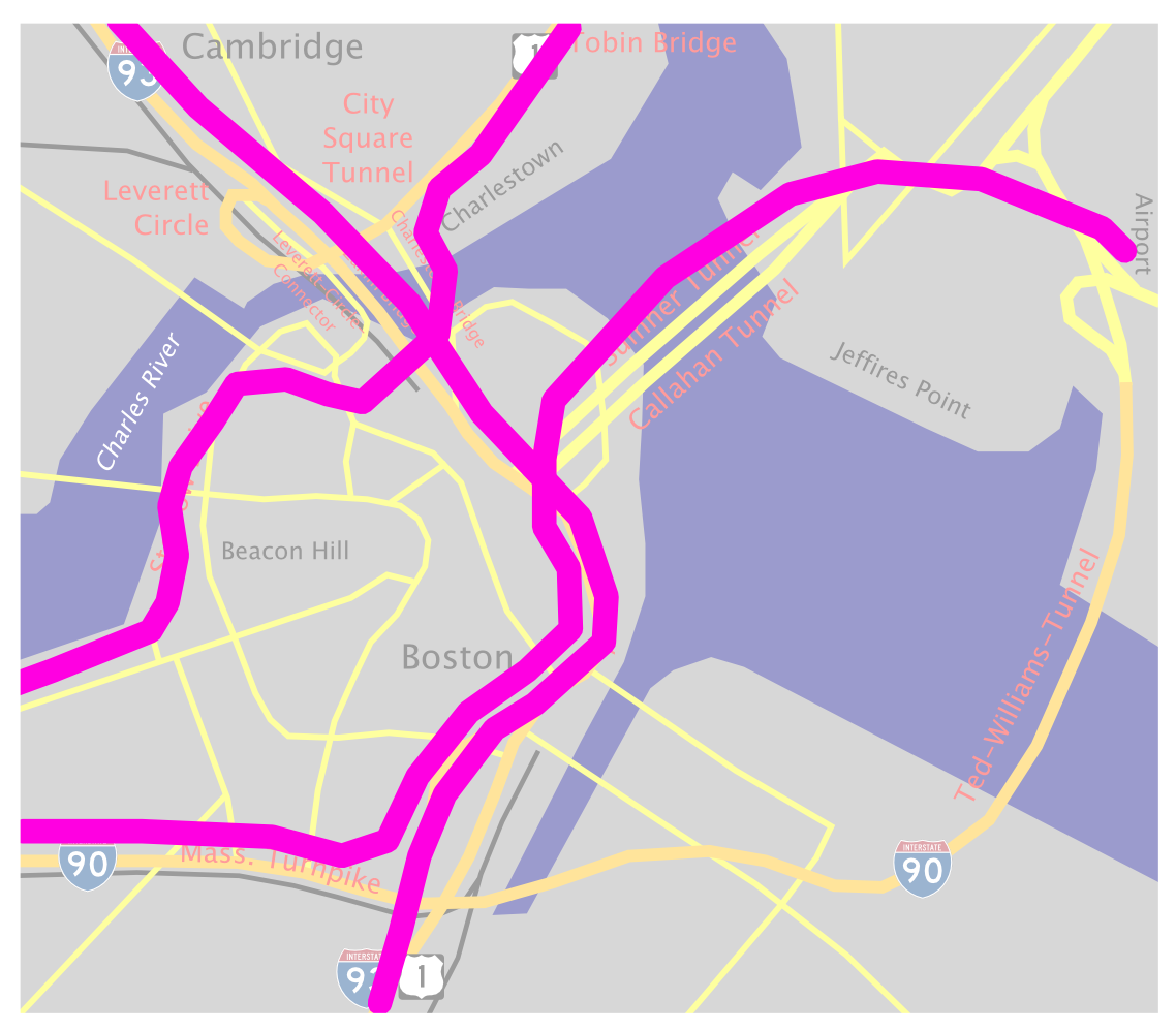
Our next project took place in the opposite side of US, the metropolis of Boston based on the edge of Atlantic Ocean. The city of Boston has a rich history with the roots of US independence starting from here. When the interstates were being built, due to poor planning Interstate 93 was built to cross in between the city's downtown. The expressway was built to support 75000 vehicles a day, but by 1990's it was carrying 200, 000 vehicles a day. The situation was very bad, there were long traffic jams. Experts predicted that if no solution is found, the crisis will lead to traffic jams of 16 hours per day by 2010. The city officials started looking for a solution when a contractor proposed a radical and bold solution - The Big Dig.
 |
| Traffic before Big Dig |
The main problem with the city were:
- Heavily congested Interstate 93 passing through the city's core downtown
- Heavily used Interstate 90 - Massachusetts Turnpike which was used to go to Logan airport and passed through Boston
- These two expressways intersected in Boston Downtown.
To solve these issues, designers envisioned taking the whole I-93 underground and removing the elevated expressway. They planned to replace the expressway with series of green spaces and parks. Moreover, they decided to extend I-90 Massachusetts Turnpike to a tunnel under harbor to directly link it to Logan Airport.
 |
| Traffic after Big Dig |
This project was very challenging and required building tunnels under the downtown and harbor without disrupting thousands of commuters using it daily. To increase the problems, the area of downtown was a landfill and was crowded with utilities and subway. The engineers had to sort out all the utilities and then design tunnels at a more depth due to presence of subways. As if this was not enough, engineers found that the soil was not string enough to support the digging of tunnels. Engineers brainstormed on the issue a lot, and later found the solution in Tokyo Japan, where they inject a mixture of concrete to strengthen the soil. There were so many more problems with this mega project like moving these massive pieces to place in these crowded city lined with low bridges. But, in the end after construction stopped in 2007, the impossible task was done. The Big was completed after a massive expenditure cost of $22 billion as per Boston Globe.
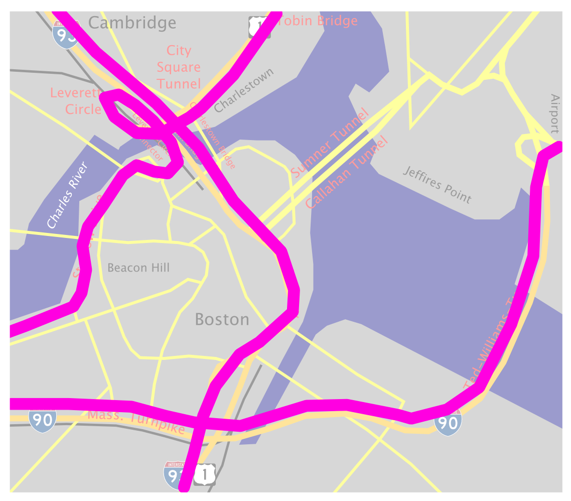
The whole time it took to complete Big Dig from planning in 1982 to completion in 2007 took a massive 25 years. People have called it the most expensive highway project in US. But, to engineers Big Dig will be always one of the most perfect examples of extreme engineering.
 |
| Current map of Boston Downtown with changes by Big Dig visible |
 |
| Changes in Boston after Big Dig |


No comments:
Post a Comment